Sunday, 29 August 2021

Pandar Dhod ( Raja Rani Waterfall ) : lesser known place in Purna Wildlife Sanctury

Raja Rani waterfall name from 2 water fall near arond, it called raja rani, also called as pandar dhod
Date : 29 /8/2021
Route : Surat- NH 8 - Kadodra- Palsana - Bardoli - Vyra - Trun right side toward bhenskatri-mahal road- turn left from dolra- jhankhri - dholia - Kosimda village - Ask local or follow google map till dead end.
Another route from Dardi village in their no much hiking

we started our journey from 6.30am from utran, we are 5 doctor friends. Dr Nitin kanani ( CEO Vahcare Healthcare ) Dr Manoj Savani  ( Savin Skin Care ) Dr Kashypa Choudhry ( Dentist ) Dr jaydev Dhameliya ( Candor IVF & radha Hospital ) Dr Bharat Savani ( shyamosa Skin Care ). we take first half at duliya chokdi near bardoli for tea break. 
next move towward madhi khami for breakfast, we eat delicious khamni with petis. afterword reach vyara & the start google map, follow google map & local support reach at base point where fall started. 
ask local guy support from retired  school teacher who leave near starting point. he manage local guide name gomabhai. he came with us & guide us route. it take 1 hrs to reach top of the fall. 3km distance need high endurance for reach their. after relaxing top again descend as base of fall. too risky trek downside. 
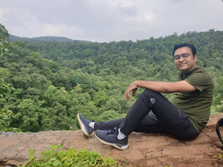
Avoid children this trek. at downside big rocks with too much lil at their make more sleepery. we remove our shoes & shock & reach base of fall with bare foot. amazing experience at down side of fall. take few pics & then came again top of fall.




Sunday, 15 August 2021

Ankda waterfall, Near Vangan ( Vansda) Natural Beauty of Dang

Ankda waterfall is one of the top and best destinations for family and friends If you like Greenery & waterfall. Ankda waterfall also known as Vangan Waterfall in google map.

Route: Surat- NH 8- Palsana - Bardoli - Mahuva - Unai - Vansda- toward saputara road - mahuvas- Turn right side Navtad- Ambapani - Vangan|
Date : 15 Aug 2021

People of Vangan Village is cooperative & Helpful. Unseen natural beauty is in vangan. If you are trek lover, you have good news their is vangan hill, which you can do by trekking & reach top of hill. need support of local guy.
Water fall is three step & height is around 100-150 feets with sub branches at downside. from top main strem fall afterwrds it down in small multiple branch & people can enjoy bathing under fall. It is best place for natural photography. Once you reach vangan village, car is drive through 1km & Then You have to park car, local village people charge 50/- per car. then u asend more 1 and half km to reach fall.
you can get home made food also, u can order local villager & food conatin roti, sabji, dal rice. if u bring your own home food they provide space for sitting if outside is raining. people of vangan is supportive.


Thursday, 15 July 2021

Places Visit In & around Dang ( On way between Surat to Saputara)

સુરત થી સાપુતારા કે આહવા બાજુ જતા રસ્તામાં ફરવા લાયક સ્થળો...ના ગુગલ મેપ , પ્રાકૃતિક જગ્યાઓ , ધોધ, ઝરણાં, જંગલો, મંદિરો,વગેરે.🌳🌴🌿🌱🏞️🌊🏔️


જાનકી વન.
https://maps.app.goo.gl/PW9JZcUFifkhVGb49

https://movewithoutmap.blogspot.com/2015/09/janki-van-at-bhinar-in-vasda-taluka-of.html


દંડકવન આશ્રમ વાંસદા
Dandakvan Ashram, Vihangam Yoga

https://maps.app.goo.gl/Epbyik6DmbY7TS2PA


વાંગણ ધોધ.
https://maps.app.goo.gl/m8rWLuwmviTH4eWbA
https://movewithoutmap.blogspot.com/2021/08/ankda-waterfall-near-vangan-vansda.html


બિલપુડી માવલી માતા વોટરફોલ


ગણેશ ધોધ 

Kilad ઇકો ટુરિઝમ
Kilad Eco Tourism, Navsari, Gujarat 396445. 098245 11561
https://maps.app.goo.gl/TGAr3PcQNk7ftg296

https://movewithoutmap.blogspot.com/2021/06/kilad-eco-camp-site-near-waghai-vansda.html


વઘઈ બોટનિકલ ગાર્ડન
https://g.co/kgs/7TUoeq


વઘઈ ગીરા ધોધ
https://maps.app.goo.gl/L1HY3yXTZMPQYjxp9


તેજસ્વિની સંસ્કૃતિ ધામ વાશુણા.
https://goo.gl/maps/NGx5dxoaWVDnkHtX7


કદમ ડુંગર
https://goo.gl/maps/zfjAFtH2YnGKJNoU9


બરડા વોટરફોલ ( ચનખલ પાસે )
https://goo.gl/maps/SsgsPAyi7yC8rrwm6

https://movewithoutmap.blogspot.com/2018/09/bardawaterfall-hidden-beauty-of-nature.html


પાંડવા ગુફા.
https://maps.app.goo.gl/RoA77pkDDXahS8bj7


અંજની કુંડ વોટરફોલ
https://maps.app.goo.gl/4PzgRG8e6BuyKjC26


શિવઘાટ મંદિર અને વેટરફોલ
https://maps.app.goo.gl/BaYiLv8UgrhXRkvCA

પદમ ડુંગરી
https://goo.gl/maps/FdVtUhWs91c9rfuEA

https://movewithoutmap.blogspot.com/2015/08/padamdungari-eco-campsite.html


અજમલ ગઢ..વાંસદા નજીક
https://maps.app.goo.gl/TckpZQmgA73mjjk56


વિલ્સન હિલ... ધરમપુર થી 25કિમી આસપાસ
https://maps.app.goo.gl/7zhYgLwbGCpxZutG6


સબરી ધામ .... આહવા થી નવાપુર રોડ
https://maps.app.goo.gl/G9XYdLABzxFFKCyk6


કુંડા રિસોર્ટ.
વઘઈ થી સાપુતારા જતાં રસ્તામાં સૂર્ગણા બાજુ.
https://maps.app.goo.gl/mrrscfHgyR8D3ybd9


કોશમાલ વેલી વોટરફોલ વઘઇ તો કાલીબેલ રોડ પર
https://goo.gl/maps/NGx5dxoaWVDnkHtX7

https://movewithoutmap.blogspot.com/2020/09/dsc-waterfall-hidden-gems-of-kosmal.html


📜 આ સુંદર અને પ્રાકૃતિક જગ્યા ઓ પર ગંદકી કરવી નહી (સ્વચ્છતા નું ધ્યાન રાખવું).♻️🗑️

Disclaimer: Kindly visit all places with your own Risk, Number mention for perticular location is taken from internet, may be changed.

Monday, 28 June 2021

Salher Forte Trek, 2nd Height Peak in Maharastra, sahyadri range

A Perfect opportunity for backpackers and people who love admiring the rich historical heritage India – trek through narrow pathways and enjoy the open panoramic views of the surrounding mountain ranges.
Date of Journey = 27 June 2021
Route : Surat - Palsana - Bardoli - vyara - bhenskatri - mahal - chankhal - don - salher wadi - salher forte & Return- Salher wadi- Don- ahwa - vaghai - vansda - Rankuva- kharel chokdi- NH 8 - Navasari - surat.

Approx Trek time : 
5 to 6 hours for Salher Trek only
Difficulty level : Moderate - High; High endurance level required.
Height above sea level : 1,567 meters
Trekking Type : Hill Fort

Salher is the 2nd  highest fort in Maharashtra, ( 1st one is Kalsubai 1646 m) which offers spectacular views of the Baglan mountain range in Nashik. Crowned at a soaring height of 5141ft, this is one pleasant trek that provides you with the stunning views of these quaint forts

This fort has a good historic importance. Salher Fort was under Shivaji maharaj in 1671. The Mughals attacked the fort in 1672. Many soldiers died in this battle but finally Shivaji Maharaj won the battle. Of all the face to face battles between the Mughals and Shivaji Maharaj’s troops, the battle of Salher takes first place. Such a big battle was not won before. The bravery and strategy used by the Maratha troops in the battle spread far and wide and increased Shivaji Maharaj’s fame further. After winning Salher, the Marathas also captured Mulher and established their reign over the Baglan region. In the 18th century the Peshwas occupied this fort and later by the British.

This is unquie combination of new friends, we are 5 people who join this trek & plan make on 25th afternoon, & all agree to leave morning 6.00 am, we 5 are from different categories like IT field, Jwellery, Doctor, Real estate, Engineer.  we enjoy travel by intoducing ourself with our business to eachother. our first halt at Madhi Khamni, Near valol. then next stop is Don hill station, take sip of tea with rain. reach salherwadi, a base point at 10.45am.  Hire a Local Guide & start trek to ward salher forte. it is high edurance trek, with rest & trek we successfully reach at summit where parshuram mandir is at top point of salhher forte. that day totally foggy & we are under clouds, so missed enjoy the open panoramic views of the surrounding mountain ranges, but still enjoy trek.


Madhi ni khamni

@ Don Base Point

@Don Hill Station Top Point

View of Salher from Base Salher wadi
Resting Time


Difficult Time @ trek


@ Top 5141 Feet
Parshuram Mandir, Salher Fort